
From Fjord to Summit: Adventures in Norway
Norway has a way of pulling you back. For Alice, that meant mountains, fjords, glaciers, and a few VÅGA caps along the way. What follows is her guide to five spectacular and lesser-known Norwegian summits, told in her own words.
In September 2024 we took our first trip to Norway and fell in love with the country. As hikers and runners there are mountains to conquer at every turn: glaciers, biodiversity, waterfalls, fjords, nature everywhere, sea to summit. We knew we had to come back. This time round with our VÅGA caps!
In both Swedish and Norwegian Våga means to dare, to have the courage to leave your comfort zone. Ironically, Vaga in Spanish means lazy… good thing we were off on our adventures in Norway not Spain. Coincidentally, two of our weeks in Norway were spent cat sitting in Vågå, a town on the edge of Jotunheimen National Park.
Anyway, this article is going to focus on the mountain adventures we had that challenged us in some way. For all the best adventures require some type 2 fun. Although, in a land with so many mountains, it’s often finding these lesser-known adventures that is the real challenge.
So consider this a guide to five spectacular and lesser-known mountains in Norway that are accessible for a keen mountain hiker. None of these require ropes or alpine experience, but some do require scrambling and a head for heights. Do your own research: this is for planning and inspiration purposes only!
Laushornet – 1,413m – Geiranger
10 km with 4,100 ft gain.
Park at Vesterås Gard, Geiranger.
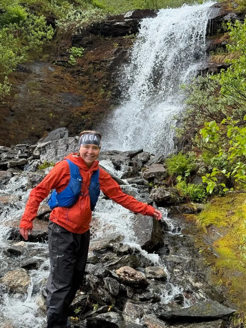
If you want to get a bird’s-eye view of the spectacular Geirangerfjord but also avoid most of the crowds, this one’s for you. Only a steep muddy slope, a waterfall crossing and the final summit push stand between you and that view.
The initial path is the same as the one to the Storseterfossen waterfall so it is well marked. You then reach a fork where you turn left; this is where it starts to get muddy and steep. Most of the ascent is spent wondering how you will get down again… A question that only rings louder in your ears as it begins to drizzle. You then reach a waterfall crossing followed by another weaving path through thick vegetation. We visited in early July so there were snow patches near the summit that we had to cross and navigate in the fog.
In a twist of fate the fog cleared briefly for us to get the beautiful view of Geiranger, a short gap that demonstrated the ever-changing weather systems in the Norwegian mountains.
Don’t forget to write in the guest book at the summit and visit the famous Storseterfossen waterfall on the way down.
Skåla – 1,848m – Loen
10 miles with 5,913 ft elevation gain.
Park at Skåla Parkering, Loen.
A challenge of fitness: how quick can you get from sea to summit? Mount Skåla’s hiking trail starts at fjord level and climbs to 1,848m. It is the longest continuous trail ascent in Norway, so grit your teeth and follow in the footsteps of the Skåla Opp race.
We first went up this mountain in September 2024. It was dramatic weather, no rain but clouds at the summit obscured the view. So this time round, on a crystal-clear July day, we knew we should put in a hard effort and beat our time. Agreeing at the car park that we would make our way up separately, we set off. Initially you weave through the woods, following the red T markers, alongside a waterfall, then up to open hill. Make sure to look out for lemmings. At around half the elevation there is a mountain lake. From here the path gets rockier as you pick your way up. It then levels out slightly before reaching the spectacular summit tower and modern cabin. Early and late season may have snow patches, a blessing as sliding down them makes the descent easier.
We both beat our previous time of 2 hours 30. Miles took 1 hour 44 and I took 2 hours 15. If you take on the challenge make sure to stop by the summit of Vesleskåla on the way down to get a good view of the lake. When back at the car we drove to Lake Lovatnet to go for a swim to cool off and get a Norwegian waffle at Kafe Båtutleige. In our opinion the best waffle we have had in Norway. Ask for the Norwegian sweet cheese as an extra topping for the full cultural experience.
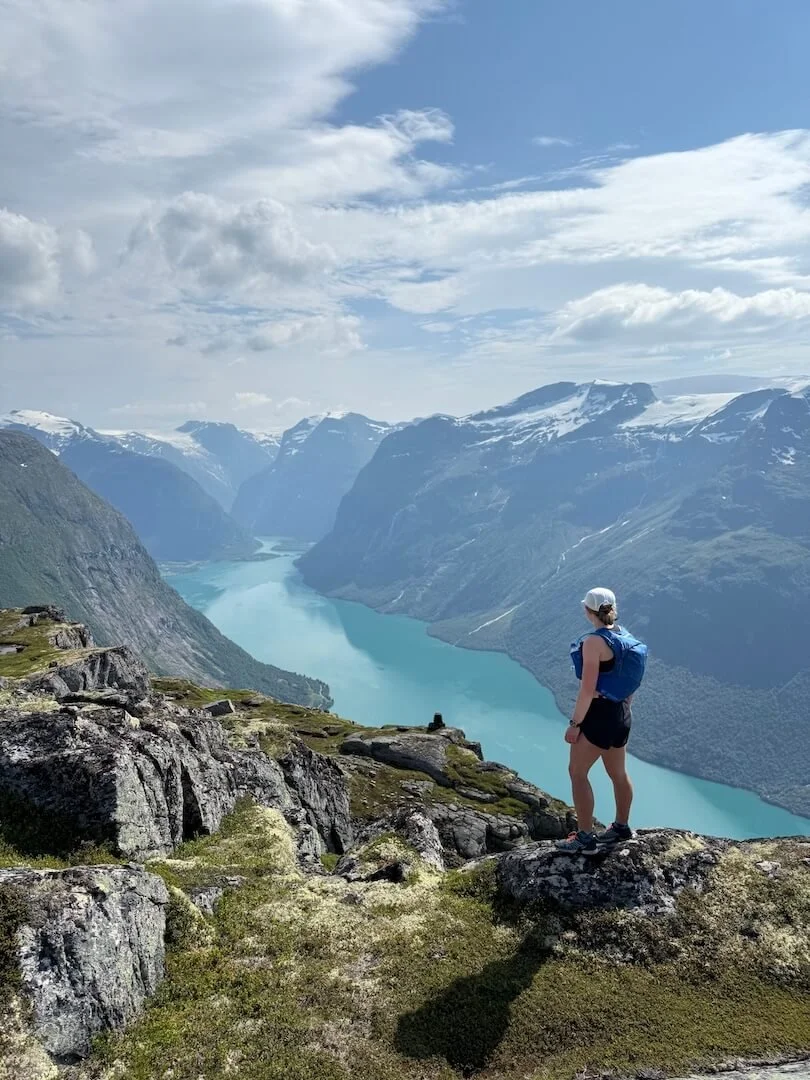
Smørstabbtinden – 2,208m – Krossbu
14 km with 3,610 ft elevation gain.
Park at Krossbu Tourist Hut.
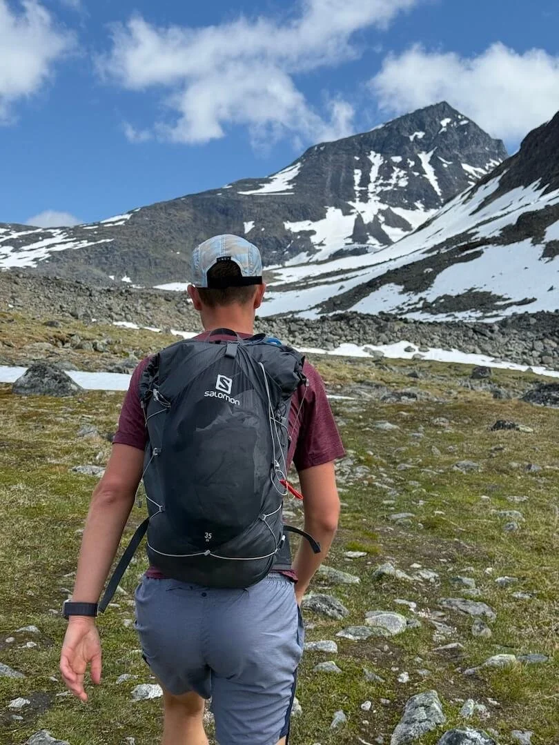
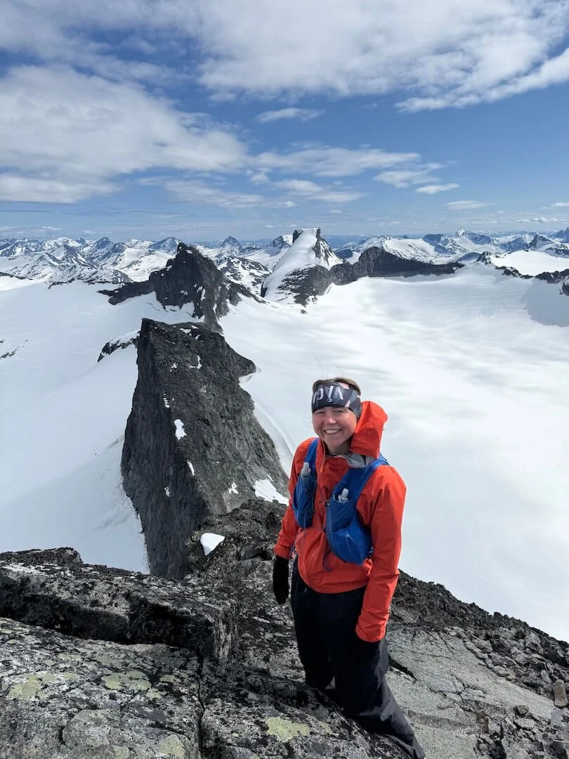
Somehow we were blessed with weeks of amazing hiking weather, not a breath of wind or hint of clag. This meant we had exhausted all of our planned hikes and had to branch out to less-trodden terrain. After finding light Strava traffic going up Smørstabbtinden, we searched in Norwegian to find more details about the feasibility of the route. Deciding we were up for the challenge, we headed up the trod towards the glacial lake, with the mountain we were about to conquer looming in the background.
We then crossed some snow patches and followed a path up to another lake. We could hear and see two people glissading down Smørstabbtinden, providing some reassurance but also demonstrating the steepness of the climb. After some discussion on which snow bridge to take across the river, we headed up. Luckily the snow was just right, not icy and not slushy. Between snow patches the path was hard to find. Although it was not scrambling, the rocks were quite loose, sometimes wet and always steep. Finally we reached the summit. It was all worth it for the view at the top looking down to the dramatic ridge line and across the glacier to Storebjørn. A quiet, peaceful summit all to ourselves and definitely one of our favourites.
On the way down it was easier to follow a faint cairned path to the left, although there were steep slippery sections we had tried to avoid on our way up. We then glissaded down the snow patches, the most childhood joy we had experienced in a long time.
Nordre Trolltind – 1,405m – Åndalsnes
14 km with 5,250 ft elevation gain.
Park opposite Trollstigen Resort (free).
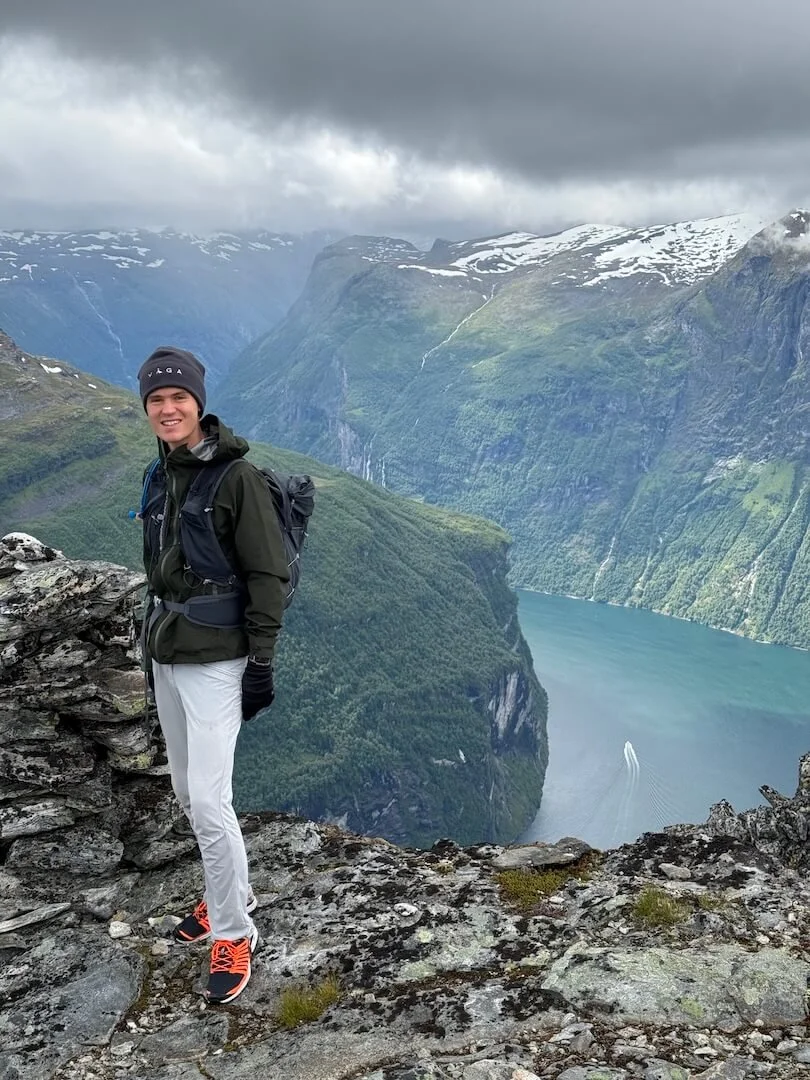
The Troll Wall is the steepest vertical cliff face in Europe, with a vertical section of 1,100m. You can hike its highest point, Store Trolltind (1,788m), from behind. However, due to the temporary closure of the famous Trollstigen road, we decided to take on the challenge of Nordre Trolltind instead. From there you can view the cliff face and the many troll-like figures that sit along the ridge line.
We set off from the car park and headed up the path through the bilberry-laden woods to Norafjellet. There are beautiful views across to Romsdalshorn and Venjetinden. From Norafjellet we crossed the river and headed up towards the snow patches following the footprints of others, something that will be harder to do once the snow melts. Under some of the snow is a thin glacier, not big enough for crevasses but still with ice to be wary of. Initially we headed up towards the ridge, however we turned around and decided to cross the snow lower down where there was less risk of slipping as we did not have ice axes with us.
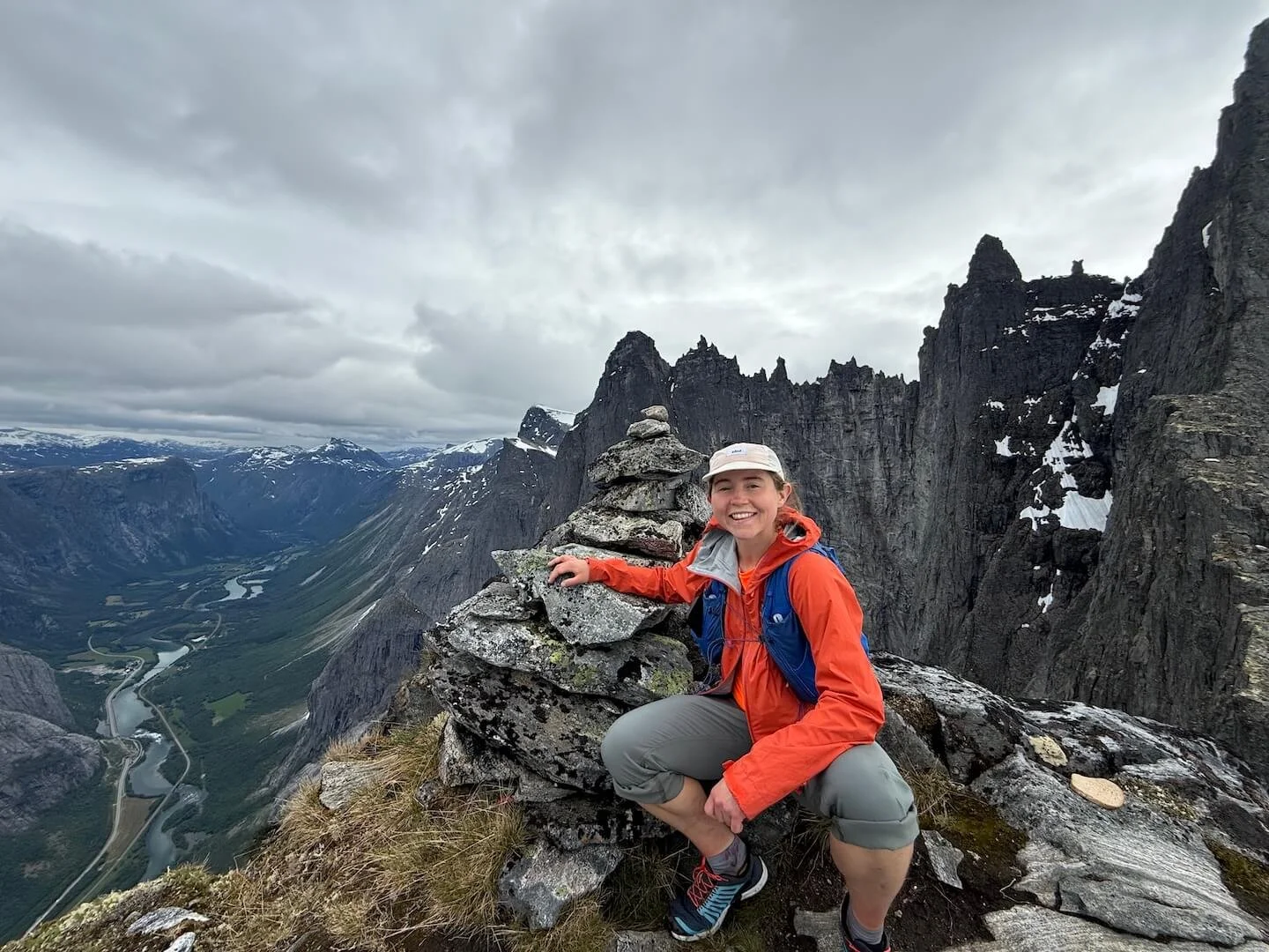
The scramble up to the summit had a series of simple, barely exposed moves. Despite appearances the only true exposure was at the summit where the sheer drop becomes apparent. This hike is as cool as it looks, a must-do if you are visiting Åndalsnes.
Hamperokken – 1,404m – Tromsø
11 km with 4,920 ft elevation gain.
Park at Storslått.
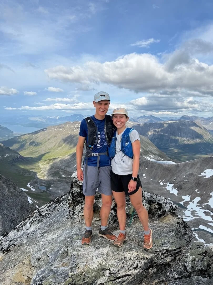
I have left the hardest yet most rewarding to last. We first visited Tromsø, the capital of the Arctic, in March 2025. As piste skiers we weren’t comfortable in the backcountry, so we borrowed our host’s snowshoes and took to the mountains on foot, causing much confusion to the locals. One of the mountains we snowshoed was Stormheimfjellet (1,222m). From here there is a pristine view of Hamperokken, at which point I turned to Miles and said: “I am not going up that!” Well, he convinced me we would make a summer ascent. My plan was to bail, but I’m so glad I didn’t.
We headed up through the forest towards the first summit, Middagsaksla. It’s one of those climbs that is the right gradient of steep to knuckle down and get some elevation in the bag. Once at the top you see the ridgeline you are about to commence. It’s spectacular but anxiety provoking. It looks like Hamperokken is impossible as you ponder how you are getting up there with no ropes. The ridge itself looks worse than it is, with only a few short sections of essential, low-technicality exposure. Eventually we took the trod that avoided the crest. With no one ahead of us we took lunch at the base of the final climb to contemplate if we felt confident enough to tackle the slanted pillar of rock.
As we took our final bite of wrap we heard voices, then a group of three lads quickly approached us. Just what we needed to egg ourselves on to the top, as they assured us we could do it. We followed them up a gully in the middle of the pillar. It was very exposed behind us and felt vertical, but the rock was solid with plenty of holds. I made a few questionable route decisions, but I made it. As I pulled up onto the small summit I wondered how I would get down again, but that was quickly replaced by the euphoria of conquering the mountain.
The views were panoramic across to the nearby peaks and the Lyngen Alps in the distance. After taking it in we headed down. At the base of the pillar we decided to go back via the lake, following a loose scree path. Doing a loop route provided some nice variation but it was hard on the legs, descending 2,500 ft in 1 mile. We were pleased to reach the car again.
Later that evening we were on YouTube and realised one of the guys we met at the top was Nikolai Schirmer, an extreme steep skier, local legend and YouTuber. That explains why he was so chill.
I hope this convinces you to take an adventure holiday in Norway. Thank you to VÅGA for our hats, they served us well.
Follow me on Instagram for more Norway content: @alice_up_high